Mechanical crack-meters
The intervention programme was concerned with the monitoring of structural damage in the walls. Following research on various methods of instrumental monitoring of the micro-movements, it was decided to use a combination of mechanical methods and other recording systems of advanced technology. For this purpose mechanical crack meters were installed on cracks in the walls. The information they provide is local but very useful, since they gather reliable information as to whether and to what extent the cracks are “active”. Measurements were repeated in 2016 and 2017 without observing any serious deviations.
Non expanding INVAR wire
At the same time (2005) an underground non-expanding INVAR wire has been installed between the stable foundation of the Parthenon and the south wall. A network of observation points has also been established on the south and east walls for monitoring the micro-movements.
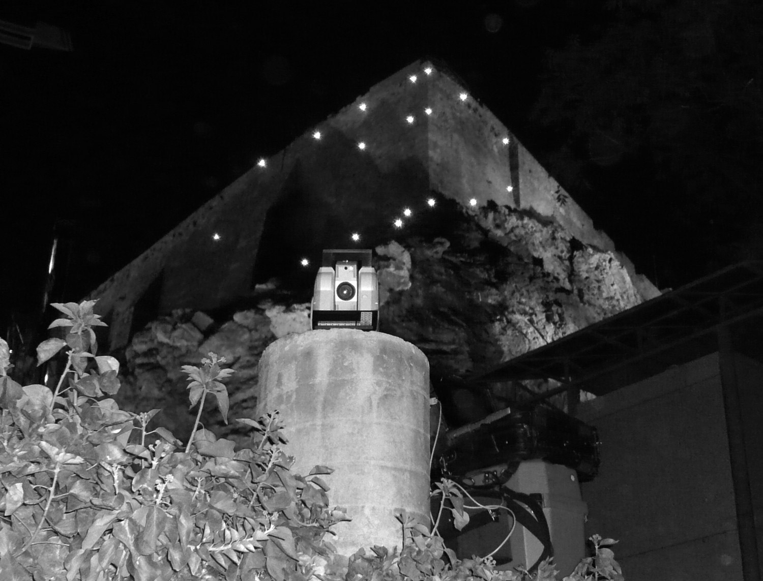
Topographic monitoring with the use of special topographic prisms
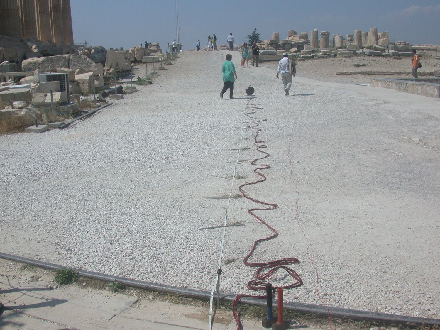
In the period 2006-2008 a high precision topographic monitoring was conducted in the north and east wall, aiming at reporting minor shifts of the walls in areas of imminent danger. The study was outsourced after a public tender and supervised by YSMA’s technical office. Measurements were obtained monthly from 52 special, permanently placed topographical prisms on the wall. Two steady pedestals were placed on the south slope of the Acropolis in order to successfully repeat the best possible relocations of the instrument. It should be pointed out that a topographical method can produce a complete picture of a large part of the wall, something very important for understanding its pathology and monitor the development of its existing damages. A long term topographical monitoring, conducted regularly during the years, can reveal more accurately the present evidence of minor shifts, especially when this information is compared with evidence produced by the optical fibres placed on the SE corner of the wall. A reconfigured topographic monitoring continues following the specifications imposed by its inclusion in the GIS data of the wall. In 2016 and 2017 the measurements were repeated but produced no significant deviations.
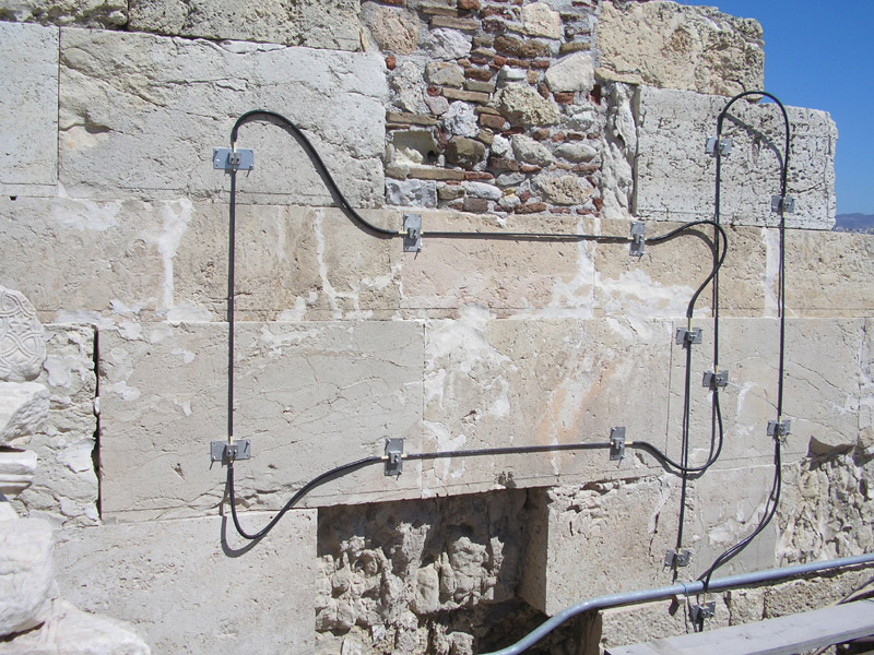
Optical fiber sensors
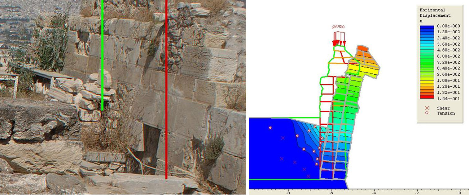
Additionally, in terms of monitoring the circuit wall, a pilot program including installation of optical fiber sensors has been realized. These sensors aim at the measurement of strains induced from mechanical or thermical actions in characteristic areas of the wall. Optical fiber sensors are the state of the art in strain monitoring and provide extremely high accuracy. They have been developed mainly around the SE corner of the wall as well as in a certain area of the North Wall in the proximity of Arryphorion filling, where the circuit wall appears intensely deformed.
Recordings until 2009 concerned temperature changes. In 2015 four fiber optics were placed, two inside and two outside, on the foundation of the west wall at the Pinakotheke of the Propylaia.
A Network of Accelerometers
The network of ten accelerometers, installed by the National Observatory of Athens, was updated and extended. Recording seismic events is constant, whereas a data base was created to assist the correlation of the parameters and the drawing of filtered information that describe the singularities of seismic waves and the way the rock and the monuments respond to them.
Optical Inspection
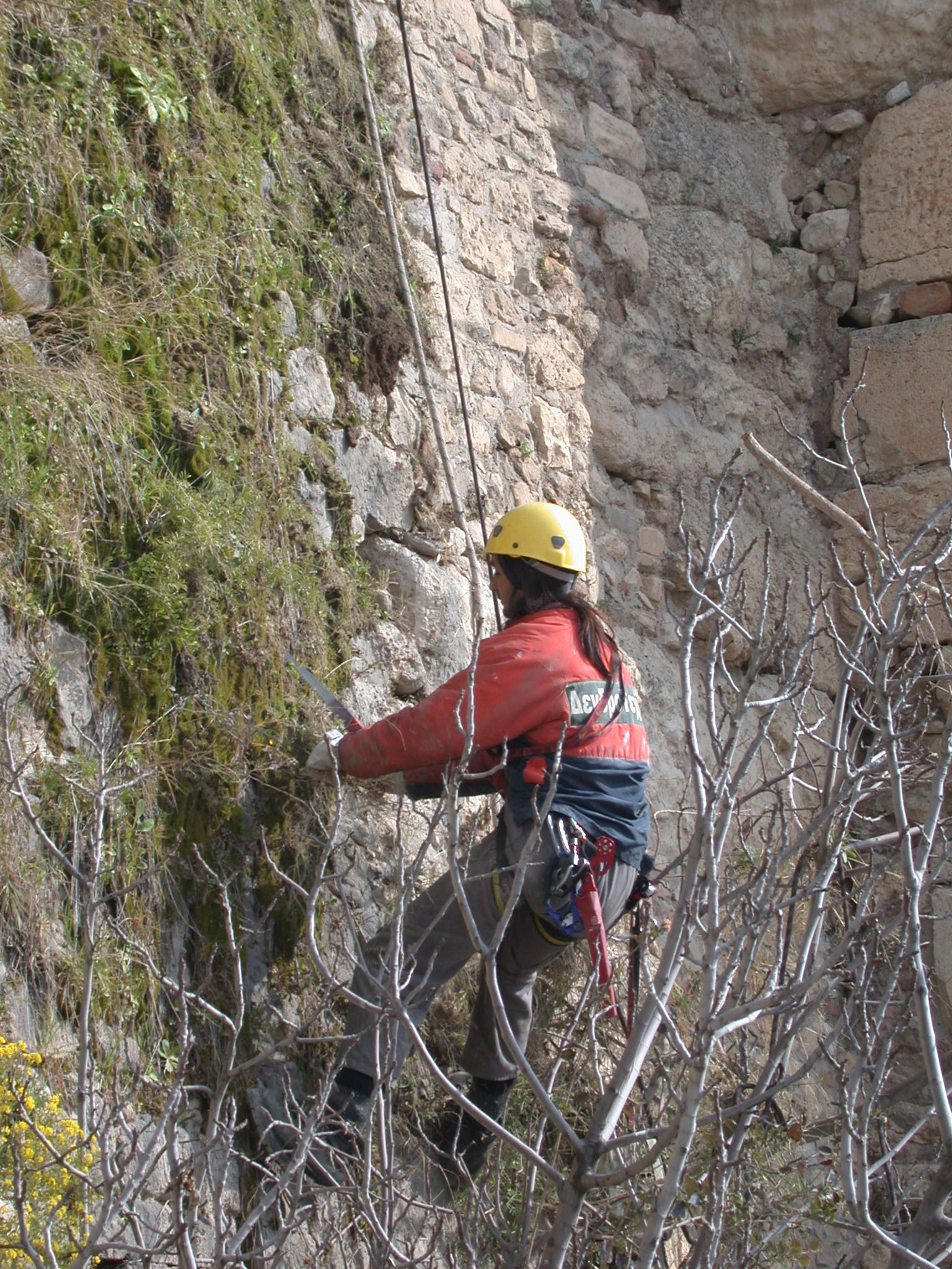
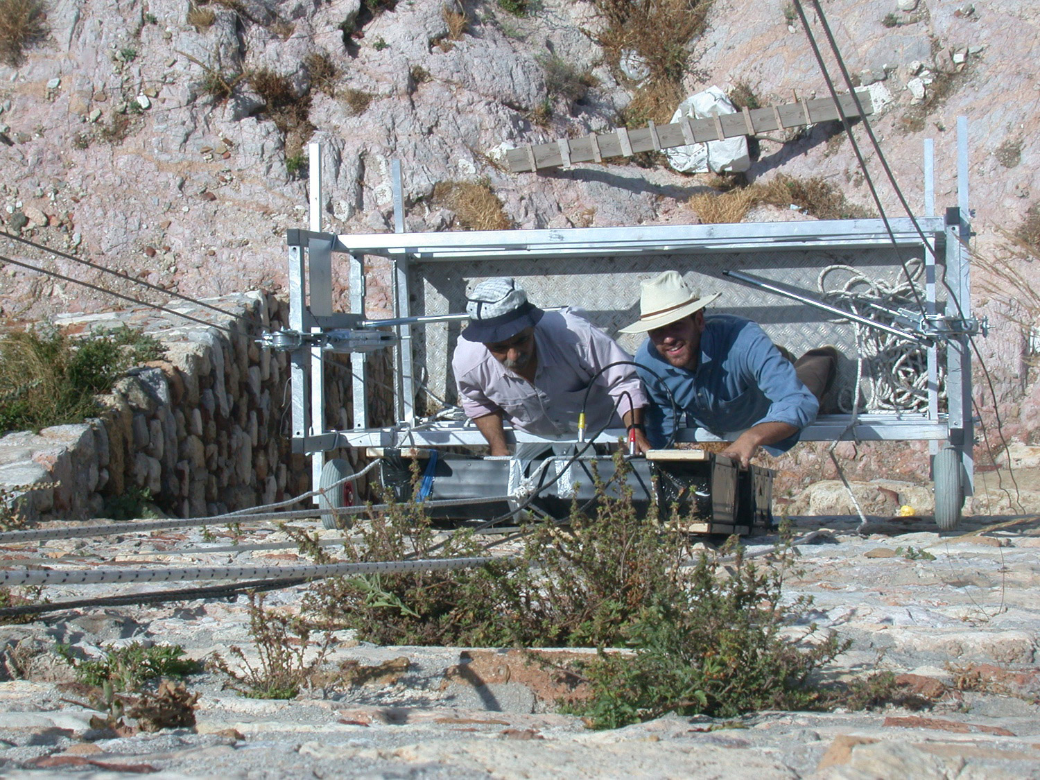
Apart from advanced technological methods, optical inspection remains a safe method of evaluating even the most problematic areas. Access to these areas is achieved with the use of a weightlifting platform for two people. By using this, surveying of the cross-section and the walls distortions is done with the practice of traditional methods. These works are conducted together with weeding, and cleaning of accretions in the drainage system that in some cases is also enhanced.
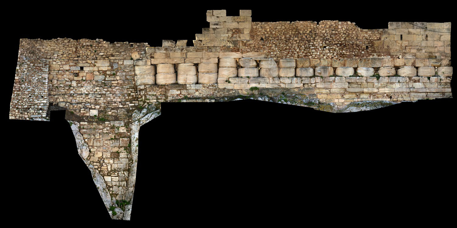
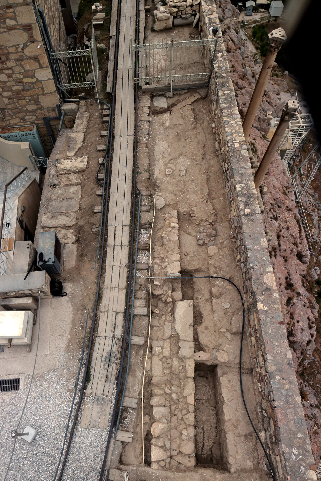
Intervention in the south wall – The area between the 6th and 7th buttress
An initial small-scale intervention was conducted in 2009 in order to restore a structural problem due to a deficiency in block support on the crown of the Wall in the area of Athena Nike. The works included taking safety measures for binding the blocks, dismantling dangerous blocks, cleaning the block joints, resetting and structurally restoring blocks by cementing and anchoring.
However, at the beginning of 2014, an instability problem appeared on the south wall of the Acropolis after a heavy downpour in February 2012, thus it was clear that an extensive intervention was imperative to begin. While planning the work of consolidating the rock masses and the walls of the Acropolis it was revealed that 12 areas of the walls demanded treatment to a greater or lesser extent.
The works started in the area between the 6th and 7th buttress of the south wall – a programme considered to be a “pilot project” for the rest of the interventions in the wall. The project, completed in July 2015, included works of archaeological cleaning, revealing the conservation state of the upper part of the wall in its full width of 6.85m, of laying asphaltic material and creating a drainage system directing rainwater runoff towards the nearby drain, of replacing damaged construction material, of filling gaps with the use of stone from Pitsa Korinthias and finally of consolidating construction mortars. During this project an endoscope, a thermal camera and other instruments, were used to investigate the structure of the wall. About 20 spolia of ancient scattered material were identified, of which the most important was part of a Roman inscription that was removed from the wall.
The beginning of the works on the walls and the rock widens the scope of activities of ESMA and YSMA. Despite the fact that the classical monuments, the walls and the rock of the Acropolis constitute a single monumental complex, fundamental differences in their structure impose a different methodological approach and consolidation. The work of restoring the wall, large parts of which incorporate later constructions due to successive repairs, demand investigation and use of other materials except marble, compatible with the construction mortars.
Intervention in the North Wall – Area B17
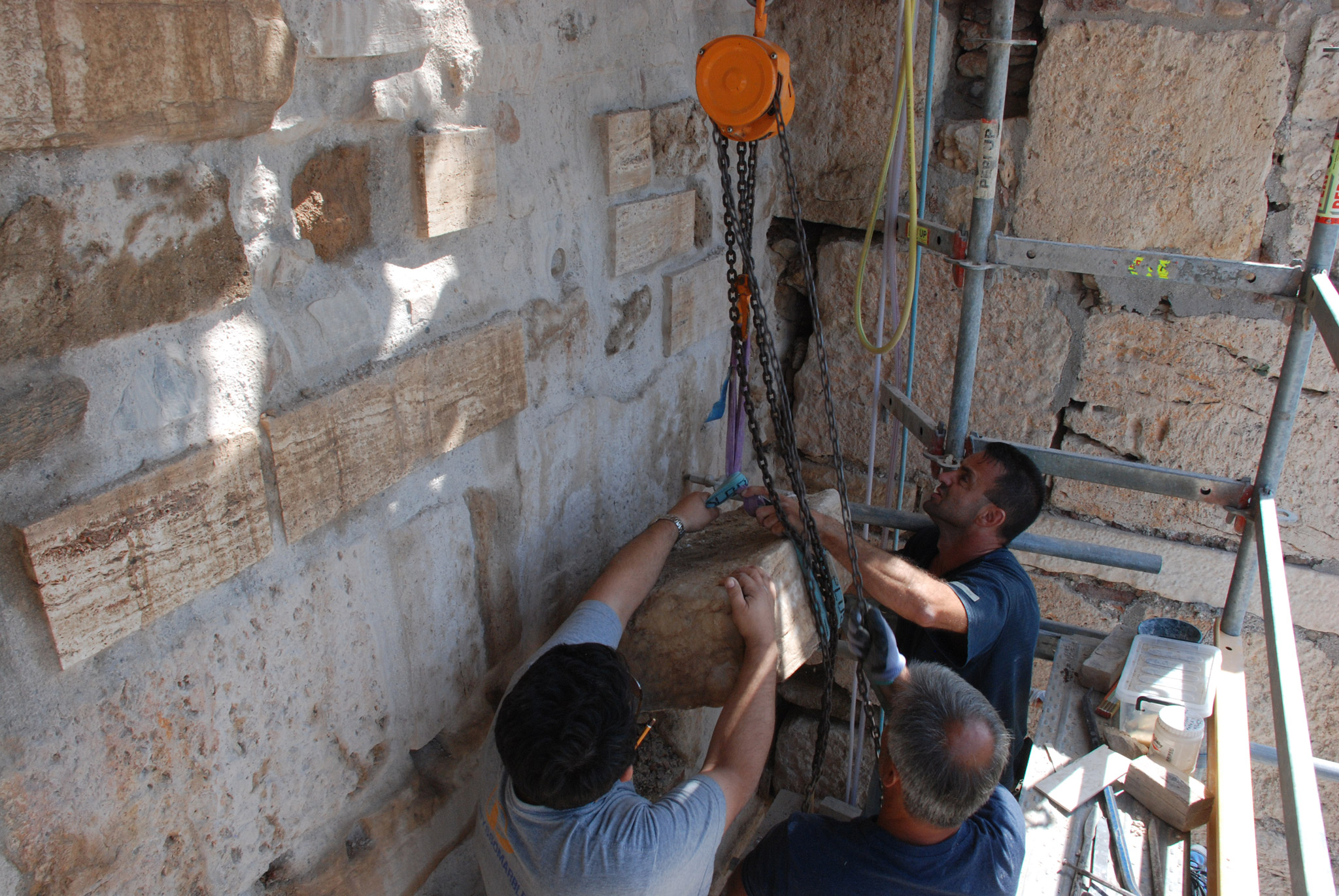
Restoration works on the north Wall began in the area B17 (27,500-35,000). A significant part of the Themistoclean Wall is demarcated by an Ottoman buttress to the east and a section repaired during the 18th to the west. The ancient wall in this area has been built of carved blocks of Piraeus stone in the opus isodomum masonry system. At this site, the inner face of the Wall was preserved to a height of 10 courses, but only six courses survived of the outer face, as the upper part had been repaired with reused ancient stones. Around the centre of the outer surface, the structure was completely disturbed, while stones had collapsed from the 7th and the 8th course.
The intervention was based on the approved pilot study by K. Mamalougas and D. Michalopoulou intended to evaluate the planned interventions in the Wall. After the study was approved, it was necessary to modify the scaffolding so as to allow the removal of the Wall’s stones without dismantling the overlying courses. In addition, a buttressing system was constructed and set up in the area that would not be dismantled during works on the underlying courses.
From 2018 to 2021, the restoration project of the outer face of the Wall’s classical phase, up to the 8th course, was implemented. In this context, two ancient stone blocks of the 7th and the 8th course, preserved in poor condition, were replaced with new ones. In addition, one block entirely built of new stone and three more were constructed and positioned on the 7th and the 8th course respectively, replacing a later (Ottoman?) repair. The building material used in the above intervention was poros stone from Pitsa in Corinthia. In the west section of the area, the existing mortars were replaced, while the stones were repointed with suitable and compatible materials following relevant research.
Drawing up a Master plan
In 2020, a group of researchers (K. Koutsadelis, E. Kakogiannou, Ch. Pinatsi, D. Michalopoulou, E. Aggelakopoulou, A. Chatzipappa, E. Xynopoulou and A. Tsimereki) submitted the “Master plan of the interventions in the Athenian Acropolis Circuit Walls”. This study constitutes the first comprehensive and fully documented appraisal of the Wall’s existing condition that takes into consideration pieces of evidence of archaeological, historical and architectural research.
It concerns the Acropolis Walls in their entirety and focuses on the analysis of the Wall’s successive repair phases, the evaluation of their problems (structural and building problems, but also issues pertaining to the enhancement of their archaeological and architectural significance). Moreover, it analyzes the question of the Wall’s building materials, their pathology, and the research into appropriate materials for their conservation. The study specifies the theoretical and technical framework of the necessary interventions in the Walls.
Intervention in the north Wall – Area Β14
Consolidation works on the north Wall, in the B14 area, near the elevator, where small stones had collapsed, as a result of which visitor access to the archaeological site was blocked, were carried out through outsourcing.
Intervention in the south-eastern corner
In 2018, consolidation works on the Wall’s south-eastern corner, and more specifically on the outer face of the east section, where small stones had fallen, were conducted by outside collaborators.
Consolidation of retaining walls
In 2020, the restoration of the retaining walls near the Mycenaean stairway, east of the Erechtheion, was launched. The intervention was decided due to the serious deterioration noticed. In accordance with the proposal “Consolidation and enhancement of the Mycenaean stairway retaining walls” by D. Michalopoulou, Ch. Pinatsi and P. Koutsadeli, the top parts of the walls were dismantled, the upper end of the west retaining wall was reconstructed, improvement works were undertaken on the upper level of the east retaining wall, and reconstructions were performed in places using rubble stones and compatible mortar. The intervention was completed in 2021.